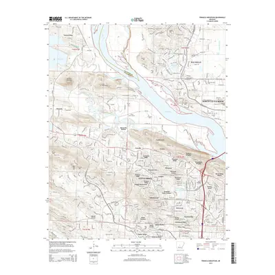
2014 Map of Pinnacle Mountain
USGS Topo · Published 2014About this map
Pinnacle Mountain towers over the confluence of the Maumelle River and the Little Maumelle River, anchoring a landscape where suburban expansion meets the steep ridges of the Fulk Mountains. The area reflects a complex history of land use, from the quiet grounds of the Old Soldiers Cem and State Hospital Cem to the modern residential corridors of Maumelle and western Little Rock. The map details the transition from riverine lowlands near Murry Lake and Natural Steps to the high ground of Shinall Mtn and Bear Den Mtn. Notable for genealogists are the numerous small burial sites, including Grimmette Cem and Hutchinson Cem, which persist even as new developments like Pleasant Valley and Woodland Heights reshape the local geography. Small aviation history is preserved at the Three Rivers Airport near Maumelle Station.
Find a feature on this map
73 named features on this map. Tap any name to fly to it.
Don’t see what you’re looking for? This feature index may not catch every label — zoom into the map to look around manually.
Map Details
Editions of this 2014 Pinnacle Mountain Map
This is the sole edition of this map. No revisions or reprints were ever made.
Other maps of this area

1890 · Benton
USGS Topo · 1:125,000

1891 · Little Rock
USGS Topo · 1:125,000

1893 · Little Rock
USGS Topo · 1:125,000

1894 · Benton
USGS Topo · 1:125,000

1935 · Little Rock
USGS Topo · 1:24,000

1935 · North Little Rock
USGS Topo · 1:24,000

1935 · Alexander
USGS Topo · 1:48,000

1938 · Benton
USGS Topo · 1:48,000

1941 · Alexander
USGS Topo · 1:62,500

1943 · Pinnacle Mtn
USGS Topo · 1:31,680