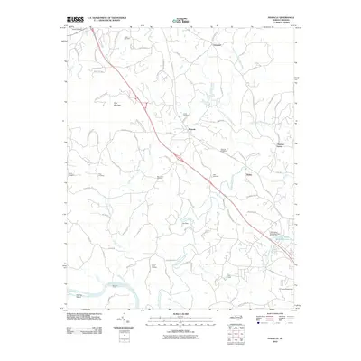
2010 Map of Pinnacle
USGS Topo · Published 2010About this map
Pinnacle and Dalton serve as the primary community hubs in this rural corridor of North Carolina, where the landscape is defined by the descent of the Little Yadkin River and its various prongs toward the Yadkin River. The terrain transitions from the protected slopes of Pilot Mountain State Park in the northwest to a patchwork of family farms and homesteads. The distribution of family and community burial grounds, such as Friends Union Cemetery, Mount Zion Cemetery, and Shiloh Cemetery, suggests long-standing ancestral ties to the land. Water management and historical crossing points are prominent features, evidenced by McLains Ford and infrastructure like Cox Dam and the C F Stone Estate Dam. This map captures a modern snapshot of the region's hydrography, including the Little Yadkin Watershed Lake Six, which regulates the drainage of Crooked Run Creek.
Find a feature on this map
92 named features on this map. Tap any name to fly to it.
Don’t see what you’re looking for? This feature index may not catch every label — zoom into the map to look around manually.
Map Details
Editions of this 2010 Pinnacle Map
This is the sole edition of this map. No revisions or reprints were ever made.
Other maps of this area

1891 · Yadkinville
USGS Topo · 1:125,000

1893 · Yadkinville
USGS Topo · 1:125,000

1951 · Rural Hall
USGS Topo · 1:24,000

1953 · Winston-Salem
USGS Topo · 1:250,000

1955 · Winston-Salem
USGS Topo · 1:250,000

1962 · Winston-Salem
USGS Topo · 1:250,000

1964 · Hanging Rock
USGS Topo · 1:24,000

1964 · Pinnacle
USGS Topo · 1:24,000

1964 · King
USGS Topo · 1:24,000

1964 · Pilot Mountain
USGS Topo · 1:24,000