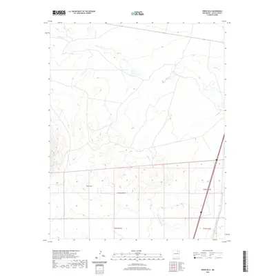
2020 Map of Pinon Hills
USGS Topo · Published 2020About this map
Pinon Hills rises across this High Plains landscape in Colfax County, defined by the winding course of Salado Cr. This 2020 U.S. Geological Survey topographic map captures a sparsely populated region of northeastern New Mexico, where the terrain transitions from the elevated mesas of the hills down to the drainage basin of the creek. The presence of the Charette Lake Canal in the southern portion of the quadrangle indicates the critical role of water management in this arid environment. Transportation through this open country is anchored by the corridor of Interstate 85 and 25, which skirts the eastern edge of the survey area. The map's detailed grid work from the Public Land Survey System, including townships t24n r21e and t24n r22e, reveals the systematic division of land across these northern New Mexican ranchlands and plains.
Find a feature on this map
9 named features on this map. Tap any name to fly to it.
Don’t see what you’re looking for? This feature index may not catch every label — zoom into the map to look around manually.
Map Details
Editions of this 2020 Pinon Hills Map
This is the sole edition of this map. No revisions or reprints were ever made.
Other maps of this area

1954 · Raton
USGS Topo · 1:250,000

1956 · Miami
USGS Topo · 1:62,500

1958 · Raton
USGS Topo · 1:250,000

1964 · Stony Lake
USGS Topo · 1:24,000

1964 · Colmor
USGS Topo · 1:24,000

1964 · Pinon Hills
USGS Topo · 1:24,000

1965 · French
USGS Topo · 1:24,000

1965 · Springer Lake
USGS Topo · 1:24,000

1965 · Springer
USGS Topo · 1:24,000
1966 · Charette Lake
USGS Topo · 1:24,000