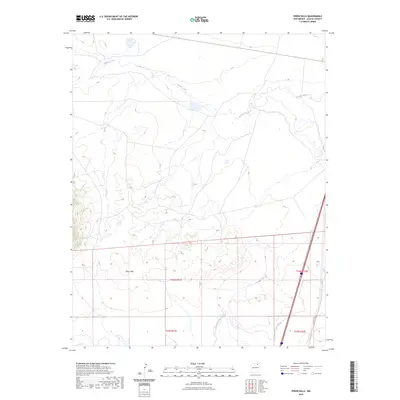
2023 Map of Pinon Hills
USGS Topo · Published 2023About this map
Pinon Hills rises across the southern half of this landscape, creating a distinct topographic break in the Colfax County high plains. The drainage of Salado Creek meanders across the northern territory, while human engineering is evident in the Charette Lake Canal which cuts through the southeastern corner. This modern survey illustrates a quiet stretch of New Mexico terrain where the intersection of natural watercourses and man-made irrigation channels defines the land use. The map clearly delineates the grid of the Public Land Survey System, including sections within t24n r21e and t24n r22e, providing a precise look at the township and range boundaries that organize this rural ranching and watershed area.
Find a feature on this map
7 named features on this map. Tap any name to fly to it.
Don’t see what you’re looking for? This feature index may not catch every label — zoom into the map to look around manually.
Map Details
Editions of this 2023 Pinon Hills Map
This is the sole edition of this map. No revisions or reprints were ever made.
Other maps of this area

1954 · Raton
USGS Topo · 1:250,000

1956 · Miami
USGS Topo · 1:62,500

1958 · Raton
USGS Topo · 1:250,000

1964 · Stony Lake
USGS Topo · 1:24,000

1964 · Colmor
USGS Topo · 1:24,000

1964 · Pinon Hills
USGS Topo · 1:24,000

1965 · French
USGS Topo · 1:24,000

1965 · Springer Lake
USGS Topo · 1:24,000

1965 · Springer
USGS Topo · 1:24,000
1966 · Charette Lake
USGS Topo · 1:24,000