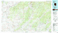
1983 Map of Pinon
USGS Topo · Published 1983About this map
Black Mesa dominates the central landscape of this 1983 survey, serving as a massive topographical anchor within the Navajo Indian Reservation and Hopi Indian Reservation. The map details a complex network of seasonal watercourses and mesas, where life centers around scattered water sources like Mormon Well and Whippoorwill Spring. The settlement of Pinon sits at the convergence of several major washes, reflecting the importance of drainage patterns in this high desert environment.
Find a feature on this map
53 named features on this map. Tap any name to fly to it.
Don’t see what you’re looking for? This feature index may not catch every label — zoom into the map to look around manually.
Map Details
Editions of this 1983 Pinon Map
2 editions found
Other maps of this area

1883 · Marsh Pass
USGS Topo · 1:250,000

1883 · Tusayan
USGS Topo · 1:250,000

1886 · Tusayan
USGS Topo · 1:250,000

1886 · Fort Defiance
USGS Topo · 1:250,000

1886 · San Francisco Mtns
USGS Topo · 1:250,000

1886 · Echo Cliffs
USGS Topo · 1:250,000

1891 · San Francisco Mtns
USGS Topo · 1:250,000

1891 · Echo Cliffs
USGS Topo · 1:250,000

1892 · Fort Defiance
USGS Topo · 1:250,000

1892 · Marsh Pass
USGS Topo · 1:250,000