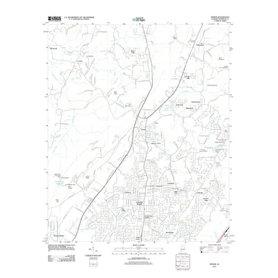
2011 Map of Pinson
USGS Topo · Published 2011About this map
Turkey Creek winds through a landscape defined by significant residential growth and industrial markers northeast of Birmingham. The area around Center Point and Pinson shows a dense suburban network, while the northern reaches retain a more varied topography near Miles Mountain and Brushy Mountain. Local historical touchstones are found at Taylors Chapel Cemetery and the Palmerdale Post Office, anchoring long-standing communities like Palmerdale and Chalkville. The map captures the complex water management of the region, including several reservoirs such as Shadow Lake and Silver Lake, alongside the specialized land use of the Turkey Creek Landfill. Significant elevation changes are marked by features like The Narrows and Cunningham Gap, illustrating the geological transition between the Appalachian foothills and the expanding urban periphery.
Find a feature on this map
195 named features on this map. Tap any name to fly to it.
Don’t see what you’re looking for? This feature index may not catch every label — zoom into the map to look around manually.
Map Details
Editions of this 2011 Pinson Map
This is the sole edition of this map. No revisions or reprints were ever made.
Other maps of this area

1889 · Birmingham
USGS Topo · 1:125,000

1892 · Birmingham
USGS Topo · 1:125,000

1895 · Birmingham
USGS Topo · 1:125,000

1904 · Birmingham Coal District
USGS Topo · 1:62,500

1905 · Leeds
USGS Topo · 1:62,500

1906 · Birmingham Special
USGS Topo · 1:62,500

1907 · Birmingham
USGS Topo · 1:125,000

1907 · Leeds
USGS Topo · 1:62,500

1951 · Warrior
USGS Topo · 1:24,000

1953 · Birmingham
USGS Topo · 1:250,000