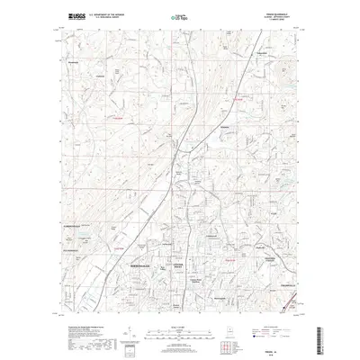
2018 Map of Pinson
USGS Topo · Published 2018About this map
Pinson serves as a central hub on this 2018 survey of northeastern Jefferson County, where suburban expansion meets the ridgelines of Red Mtn and Keeler Mtn. The landscape is defined by its numerous named valleys and gaps, such as Jones Valley, Sweeny Gap, and the topographic bottleneck at The Narrows. This era shows a dense network of residential communities and educational infrastructure, including Jefferson State Community College and neighborhoods like Larkwood and Center Point Gardens. Waterways such as Turkey Cr and Fivemile Cr weave through the terrain, while small reservoirs like Silver Lake and Old Shadow Lake dot the valleys. For local historians, the map preserves the locations of established landmarks like Sharon Ch and Pinson Cem, alongside industrial and transportation footprints like the Turkey Creek Airport. The transition from the established northern neighborhoods of Birmingham into the distinct suburbs of Grayson Valley and Clay is clearly documented.
Find a feature on this map
239 named features on this map. Tap any name to fly to it.
Don’t see what you’re looking for? This feature index may not catch every label — zoom into the map to look around manually.
Map Details
Editions of this 2018 Pinson Map
This is the sole edition of this map. No revisions or reprints were ever made.
Other maps of this area

1889 · Birmingham
USGS Topo · 1:125,000

1892 · Birmingham
USGS Topo · 1:125,000

1895 · Birmingham
USGS Topo · 1:125,000

1904 · Birmingham Coal District
USGS Topo · 1:62,500

1905 · Leeds
USGS Topo · 1:62,500

1906 · Birmingham Special
USGS Topo · 1:62,500

1907 · Birmingham
USGS Topo · 1:125,000

1907 · Leeds
USGS Topo · 1:62,500

1951 · Warrior
USGS Topo · 1:24,000

1953 · Birmingham
USGS Topo · 1:250,000