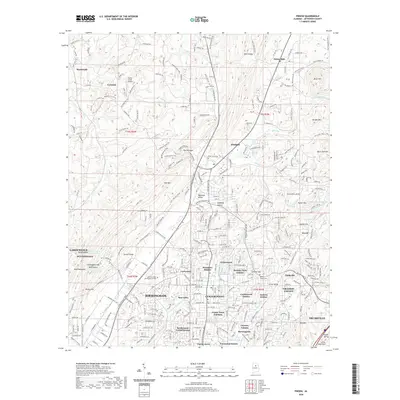
2020 Map of Pinson
USGS Topo · Published 2020About this map
Pinson and the surrounding Jefferson County communities are defined by a landscape of prominent ridges and creek valleys, where the CSX Transportation rail line follows the low ground alongside Turkey Creek. This contemporary survey captures the densely developed residential corridors stretching from Center Point and Grayson Valley in the south up toward the older settlements of Palmerdale and Monmouth to the north. Higher elevations like Miles Mountain and Brushy Mountain constrain the suburban expansion, creating a distinct pattern of neighborhood clusters like Woodaire Estates and Holiday Park Estates. Local history is anchored by sites such as the Pinson Cemetery and Taylors Chapel Cemetery, while the presence of Jefferson State Community College and the Turkey Creek Airport reflects the area's modern infrastructure and educational significance within the Birmingham metropolitan region.
Find a feature on this map
220 named features on this map. Tap any name to fly to it.
Don’t see what you’re looking for? This feature index may not catch every label — zoom into the map to look around manually.
Map Details
Editions of this 2020 Pinson Map
This is the sole edition of this map. No revisions or reprints were ever made.
Other maps of this area

1889 · Birmingham
USGS Topo · 1:125,000

1892 · Birmingham
USGS Topo · 1:125,000

1895 · Birmingham
USGS Topo · 1:125,000

1904 · Birmingham Coal District
USGS Topo · 1:62,500

1905 · Leeds
USGS Topo · 1:62,500

1906 · Birmingham Special
USGS Topo · 1:62,500

1907 · Birmingham
USGS Topo · 1:125,000

1907 · Leeds
USGS Topo · 1:62,500

1951 · Warrior
USGS Topo · 1:24,000

1953 · Birmingham
USGS Topo · 1:250,000