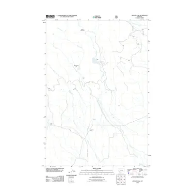
2011 Map of Pintler Lake
USGS Topo · Published 2011About this map
Pintler Creek and its many tributaries, including Roberts Creek and McCormick Creek, dominate this high-altitude landscape in the early 21st century. The map highlights the localized ranching history of the area, specifically identifying the Dreise Ranch, L Bacon Ranch, and Christensen Ranch clustered in the southern drainage areas. These established holdings mark the human footprint in a region defined by its water resources and seasonal recreation sites like the Pintler Campground.
Find a feature on this map
18 named features on this map. Tap any name to fly to it.
Don’t see what you’re looking for? This feature index may not catch every label — zoom into the map to look around manually.
Map Details
Editions of this 2011 Pintler Lake Map
This is the sole edition of this map. No revisions or reprints were ever made.
Other maps of this area

1955 · Dillon
USGS Topo · 1:250,000

1957 · Dillon
USGS Topo · 1:250,000

1958 · Dillon
USGS Topo · 1:250,000

1962 · Dillon
USGS Topo · 1:250,000

1962 · Mud Lake
USGS Topo · 1:24,000

1962 · Pine Hill
USGS Topo · 1:24,000

1962 · Pintlar Lake
USGS Topo · 1:24,000

1962 · Proposal Rock
USGS Topo · 1:24,000
1962 · Long Peak
USGS Topo · 1:24,000
1962 · Warren Peak
USGS Topo · 1:24,000