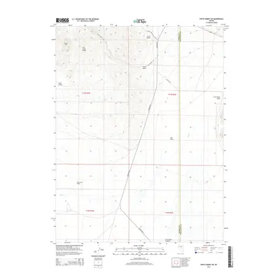
2014 Map of Pinto Summit SW
USGS Topo · Published 2014About this map
Little Smoky Valley and Fish Creek Valley dominate this Great Basin landscape, separated by the prominent Fish Creek Range. The survey captures a high-desert environment defined by seasonal drainage and ranching access, with the intermittent waters of Fish Cr flowing through the southern flats. Significant canyons, including Secret Canyon and Ratto Canyon, cut through the range, providing historical access routes between the valleys. The presence of the Wind Fall Mine Secret Canyon Rd and Todd Farm Rd indicates the localized intersections of mining and agricultural activity at the Eureka and White Pine county line. Centered on the Rye Patch area, the map reveals a system of local connectors like Duckwater Rd that historically linked these high valleys to broader Nevada commerce.
Find a feature on this map
18 named features on this map. Tap any name to fly to it.
Don’t see what you’re looking for? This feature index may not catch every label — zoom into the map to look around manually.
Map Details
Editions of this 2014 Pinto Summit SW Map
This is the sole edition of this map. No revisions or reprints were ever made.
Other maps of this area

1926 · Roberts Mountains
USGS Topo · 1:250,000

1929 · Roberts Mountains
USGS Topo · 1:250,000

1953 · Pinto Summit
USGS Topo · 1:62,500

1955 · Millett
USGS Topo · 1:250,000

1956 · Bellevue Peak
USGS Topo · 1:62,500

1956 · Cockalorum Wash
USGS Topo · 1:62,500

1956 · Ely
USGS Topo · 1:250,000

1959 · Ely
USGS Topo · 1:250,000

1959 · Millett
USGS Topo · 1:250,000

1963 · Ely
USGS Topo · 1:250,000