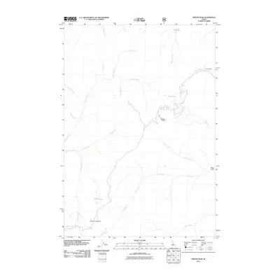
2011 Map of Pinyon Peak
USGS Topo · Published 2011About this map
Pinyon Peak stands as the central landmark of this high-elevation terrain in Custer County, Idaho. The landscape is defined by a dense network of mountain drainages, including the headwaters of Loon Creek and Little Loon Creek. Significant water features such as Pinyon Lake, Kidney Lake, and Blue Lake are dispersed across the ridges, providing critical points of reference in this roadless area. Evidence of the region’s mineral history is marked by the Lost Packer Mine located near Canyon Creek in the northeast. The map also detail topographic highlights like Feltham Creek Point and the deep incision of Packer Gulch, illustrating the complex drainage patterns of the Salmon River mountains watershed. The absence of modern infrastructure emphasizes the preserved wilderness character of the Challis National Forest lands.
Find a feature on this map
24 named features on this map. Tap any name to fly to it.
Don’t see what you’re looking for? This feature index may not catch every label — zoom into the map to look around manually.
Map Details
Editions of this 2011 Pinyon Peak Map
This is the sole edition of this map. No revisions or reprints were ever made.
Other maps of this area

1891 · Bear Valley
USGS Topo · 1:125,000

1893 · Bear Valley
USGS Topo · 1:125,000

1919 · Custer
USGS Topo · 1:125,000

1922 · Custer
USGS Topo · 1:125,000

1930 · Casto
USGS Topo · 1:125,000

1957 · Challis
USGS Topo · 1:250,000

1960 · Challis
USGS Topo · 1:250,000

1961 · Greyhound Ridge
USGS Topo · 1:62,500

1963 · Challis
USGS Topo · 1:250,000

1963 · Pinyon Peak
USGS Topo · 1:24,000