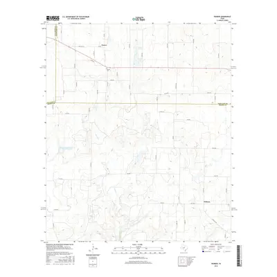
2016 Map of Pioneer
USGS Topo · Published 2016About this map
Pioneer stands at the northern edge of this West Texas landscape, where the borders of Callahan, Eastland, and Brown counties converge. The settlement is centered around the junction of FM 569 and Ranch Rd 374, with the Pioneer Cem serving as a primary local landmark for genealogical research. Further south, the community of Williams sits along Hwy 583 W, positioned near the winding course of Lost Creek. The terrain is defined by a network of seasonal watercourses, including Paint Creek and the Red River, which feed into local impoundments such as Phil-Pe-Co Lake and the Soil Conservation Service Site 34 Reservoir. This mid-2010s survey illustrates a rural ranching economy dependent on an extensive system of farm-to-market and county roads that navigate the subtle drainages and divides of the region.
Find a feature on this map
50 named features on this map. Tap any name to fly to it.
Don’t see what you’re looking for? This feature index may not catch every label — zoom into the map to look around manually.
Map Details
Editions of this 2016 Pioneer Map
This is the sole edition of this map. No revisions or reprints were ever made.
Other maps of this area

1887 · Coleman
USGS Topo · 1:125,000

1889 · Brownwood
USGS Topo · 1:125,000

1889 · Coleman
USGS Topo · 1:125,000

1894 · Eastland
USGS Topo · 1:125,000

1894 · Brownwood
USGS Topo · 1:125,000

1924 · Coleman 1-a
USGS Topo · 1:48,000

1924 · Brownwood Reservoir Site
USGS Topo · 1:48,000

1927 · Grosvenor
USGS Topo · 1:62,500

1931 · Baird
USGS Topo · 1:125,000

1932 · Baird
USGS Topo · 1:125,000