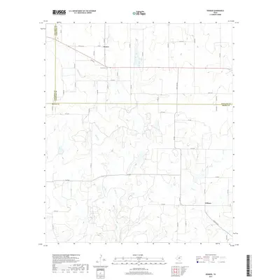
2019 Map of Pioneer
USGS Topo · Published 2019About this map
The settlement of Pioneer sits at the junction of FM 569 and Ranch Rd 374, serving as a central point in this rural landscape near the convergence of Eastland, Callahan, and Brown counties. This area is defined by the winding paths of Red River, Paint Creek, and Lost Creek, which cut through the terrain. To the south, the community of Williams is situated along Ranch Rd 583, illustrating the dispersed residential patterns typical of this part of Texas. Local history is anchored at the Pioneer Cemetery, located just east of its namesake town along the highway. The map meticulously details a dense network of county roads, such as County Road 239 and County Road 432, providing a clear view of how these remote properties and family lands are interconnected.
Find a feature on this map
50 named features on this map. Tap any name to fly to it.
Don’t see what you’re looking for? This feature index may not catch every label — zoom into the map to look around manually.
Map Details
Editions of this 2019 Pioneer Map
This is the sole edition of this map. No revisions or reprints were ever made.
Other maps of this area

1887 · Coleman
USGS Topo · 1:125,000

1889 · Brownwood
USGS Topo · 1:125,000

1889 · Coleman
USGS Topo · 1:125,000

1894 · Eastland
USGS Topo · 1:125,000

1894 · Brownwood
USGS Topo · 1:125,000

1924 · Coleman 1-a
USGS Topo · 1:48,000

1924 · Brownwood Reservoir Site
USGS Topo · 1:48,000

1927 · Grosvenor
USGS Topo · 1:62,500

1931 · Baird
USGS Topo · 1:125,000

1932 · Baird
USGS Topo · 1:125,000