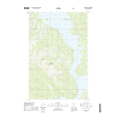
2020 Map of Pioneer Ridge
USGS Topo · Published 2020About this map
Flathead National Forest land defines this section of Montana, where the waters of the Hungry Horse Reservoir meet the steep slopes of the northern Rockies. The reservoir dominates the eastern half of the map, isolating landmarks like Elk Island and Lost Island from the mainland. The terrain is characterized by a complex network of drainage basins, with numerous named streams such as Mazie Cr, Emma Cr, and Florinda Cr flowing toward the reservoir from the heights of Pioneer Ridge.
Find a feature on this map
47 named features on this map. Tap any name to fly to it.
Don’t see what you’re looking for? This feature index may not catch every label — zoom into the map to look around manually.
Map Details
Editions of this 2020 Pioneer Ridge Map
This is the sole edition of this map. No revisions or reprints were ever made.
Other maps of this area

1914 · Nyack
USGS Topo · 1:125,000

1958 · Quintonkon
USGS Topo · 1:24,000

1958 · Felix Peak
USGS Topo · 1:24,000

1960 · Cut Bank
USGS Topo · 1:250,000

1963 · Cut Bank
USGS Topo · 1:250,000

1964 · Cut Bank
USGS Topo · 1:250,000
1964 · Jewel Basin
USGS Topo · 1:24,000

1964 · Pinnacle
USGS Topo · 1:24,000
1964 · Nyack SW
USGS Topo · 1:24,000
1964 · Crater Lake
USGS Topo · 1:24,000