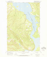
1964 Map of Pioneer Ridge
USGS Topo · Published 1968About this map
Hungry Horse Reservoir dominates the eastern half of this landscape, its shoreline meticulously surveyed with a normal pool elevation of 3560 feet. This mid-1960s study of the Flathead National Forest reveals the infrastructure of forest management and early recreation, from the Pioneer Lookout Tower atop Pioneer Ridge to the Anna Creek Guard Station near the water's edge.
Find a feature on this map
36 named features on this map. Tap any name to fly to it.
Don’t see what you’re looking for? This feature index may not catch every label — zoom into the map to look around manually.
Map Details
Editions of this 1964 Pioneer Ridge Map
This is the sole edition of this map. No revisions or reprints were ever made.
Other maps of this area

1914 · Nyack
USGS Topo · 1:125,000

1958 · Quintonkon
USGS Topo · 1:24,000

1958 · Felix Peak
USGS Topo · 1:24,000

1960 · Cut Bank
USGS Topo · 1:250,000

1963 · Cut Bank
USGS Topo · 1:250,000

1964 · Cut Bank
USGS Topo · 1:250,000
1964 · Jewel Basin
USGS Topo · 1:24,000

1964 · Pinnacle
USGS Topo · 1:24,000
1964 · Nyack SW
USGS Topo · 1:24,000
1964 · Crater Lake
USGS Topo · 1:24,000