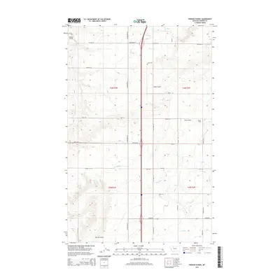
2014 Map of Pioneer School
USGS Topo · Published 2014About this map
Agricultural development and water management define this section of Pondera County, where a complex network of irrigation infrastructure supports the high plains landscape. The Pioneer School stands as a local landmark amidst a grid of rural roads, including Valier Hwy E and Old Shelby Rd. The terrain is carved by natural drainage features like Schultz Coulee and Hilger Coulee, which contrast with the engineered precision of the many irrigation channels. Canals and ditches such as the S Canal, K 7 Ditch, and S-Seven Ditch crisscross the townships, illustrating the intensive water engineering required for farming in this region. This 2014 survey captures the intersection of natural topography, like the Big Flat Coulee, with the modern transportation corridor of US Highway 91 N.
Find a feature on this map
43 named features on this map. Tap any name to fly to it.
Don’t see what you’re looking for? This feature index may not catch every label — zoom into the map to look around manually.
Map Details
Editions of this 2014 Pioneer School Map
This is the sole edition of this map. No revisions or reprints were ever made.
Other maps of this area

1920 · Dupuyer
USGS Topo · 1:125,000

1920 · Conrad
USGS Topo · 1:125,000

1934 · Valier
USGS Topo · 1:62,500

1937 · Valier
USGS Topo · 1:62,500

1938 · Gallup City
USGS Topo · 1:62,500

1942 · Gallup City
USGS Topo · 1:62,500

1954 · Shelby
USGS Topo · 1:250,000

1958 · Shelby
USGS Topo · 1:250,000

1960 · Cut Bank
USGS Topo · 1:250,000

1963 · Cut Bank
USGS Topo · 1:250,000