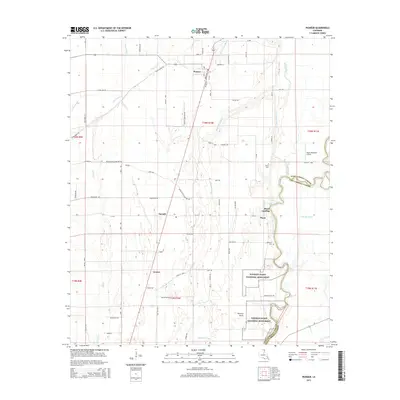
2015 Map of Pioneer
USGS Topo · Published 2015About this map
Poverty Point National Monument anchors the southeastern corner of this West Carroll Parish landscape, preserving ancient earthworks near the banks of Bayou Macon. The settlement of Pioneer serves as a local hub to the north, situated along the crossroads of Broadway St and La-588. This region is defined by its intricate drainage network, where Alligator Bayou, Indian Bayou, and Hurricane Cr wind through the alluvial plain. Further south, the map reveals the hamlets of Floyd and Darnell, alongside the historic Floyd Landing. The agricultural character of the area is underscored by the grid of rural roads and scattered landmarks such as Wilson Cem and Bethany Cem, which provide specific points of interest for genealogists tracking family roots in this corner of Louisiana.
Find a feature on this map
71 named features on this map. Tap any name to fly to it.
Don’t see what you’re looking for? This feature index may not catch every label — zoom into the map to look around manually.
Map Details
Editions of this 2015 Pioneer Map
This is the sole edition of this map. No revisions or reprints were ever made.
Other maps of this area

1909 · Baxter Bayou
USGS Topo · 1:24,000

1911 · Baxter Bayou
USGS Topo · 1:24,000

1914 · Baxter Bayou
USGS Topo · 1:31,680

1935 · Hurricane
USGS Topo · 1:62,500

1935 · Oak Grove
USGS Topo · 1:62,500

1935 · Bonita
USGS Topo · 1:62,500

1955 · Jackson
USGS Topo · 1:250,000

1958 · Oak Grove
USGS Topo · 1:62,500

1958 · Hurricane
USGS Topo · 1:62,500

1958 · Bonita
USGS Topo · 1:62,500