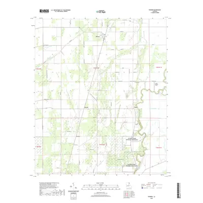
2020 Map of Pioneer
USGS Topo · Published 2020About this map
Poverty Point National Monument dominates the southern landscape of this West Carroll Parish survey, where the ancient earthworks are traced by a Self-Guided Trail. The settlement of Pioneer sits at a junction in the north, defined by a grid of streets including Main St and Broadway St. The terrain is deeply intertwined with the slow-moving waters of Bayou Macon, which serves as the boundary between West Carroll and East Carroll Parish.
Find a feature on this map
54 named features on this map. Tap any name to fly to it.
Don’t see what you’re looking for? This feature index may not catch every label — zoom into the map to look around manually.
Map Details
Editions of this 2020 Pioneer Map
This is the sole edition of this map. No revisions or reprints were ever made.
Other maps of this area

1909 · Baxter Bayou
USGS Topo · 1:24,000

1911 · Baxter Bayou
USGS Topo · 1:24,000

1914 · Baxter Bayou
USGS Topo · 1:31,680

1935 · Hurricane
USGS Topo · 1:62,500

1935 · Oak Grove
USGS Topo · 1:62,500

1935 · Bonita
USGS Topo · 1:62,500

1955 · Jackson
USGS Topo · 1:250,000

1958 · Oak Grove
USGS Topo · 1:62,500

1958 · Hurricane
USGS Topo · 1:62,500

1958 · Bonita
USGS Topo · 1:62,500