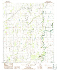
1986 Map of Pioneer
USGS Topo · Published 1987About this map
Poverty Point State Park anchors the southern portion of this Mississippi Delta landscape, where the ancient Indian Mound earthworks overlook the winding course of Bayou Macon. The map documents a predominantly agricultural region defined by an intricate network of levees and watercourses, including Hurricane Creek, Caney Bayou, and Alligator Bayou. Along the Missouri Pacific railroad line, the small settlements of Pioneer and Darnell serve as local hubs, while the community of Floyd sits just west of the parish boundary. The terrain is marked by its relationship to the water, from the complex drainage of Lyon Mill Bayou to the oxbow-like curve of Long Lake, reflecting the alluvial character of the border between West Carroll Parish and East Carroll Parish.
Find a feature on this map
20 named features on this map. Tap any name to fly to it.
Don’t see what you’re looking for? This feature index may not catch every label — zoom into the map to look around manually.
Map Details
Editions of this 1986 Pioneer Map
This is the sole edition of this map. No revisions or reprints were ever made.
Other maps of this area

1909 · Baxter Bayou
USGS Topo · 1:24,000

1911 · Baxter Bayou
USGS Topo · 1:24,000

1914 · Baxter Bayou
USGS Topo · 1:31,680

1935 · Hurricane
USGS Topo · 1:62,500

1935 · Oak Grove
USGS Topo · 1:62,500

1935 · Bonita
USGS Topo · 1:62,500

1955 · Jackson
USGS Topo · 1:250,000

1958 · Oak Grove
USGS Topo · 1:62,500

1958 · Hurricane
USGS Topo · 1:62,500

1958 · Bonita
USGS Topo · 1:62,500