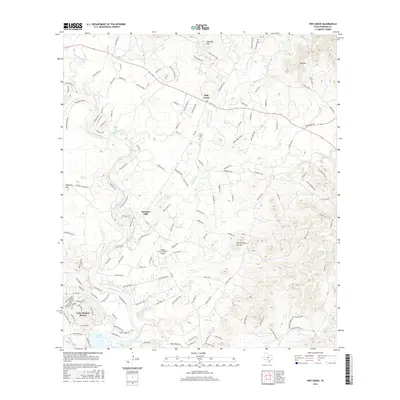
2016 Map of Pipe Creek
USGS Topo · Published 2016About this map
The Medina River carves through the heart of this landscape, its path defined by natural landmarks like Wonder Hole and the cascading waters at Bandera Falls. This 2016 survey captures the residential growth around Lake Medina Shores and the northern reaches of Medina Lake, where the river begins its transition into the reservoir. To the north, the small community of Pipe Creek is anchored by the Pipe Creek Cem, serving as a focal point for local genealogy and history.
Find a feature on this map
152 named features on this map. Tap any name to fly to it.
Don’t see what you’re looking for? This feature index may not catch every label — zoom into the map to look around manually.
Map Details
Editions of this 2016 Pipe Creek Map
This is the sole edition of this map. No revisions or reprints were ever made.
Other maps of this area

1954 · San Antonio
USGS Topo · 1:250,000

1956 · Comfort
USGS Topo · 1:62,500

1956 · Bandera
USGS Topo · 1:62,500

1956 · Medina Lake
USGS Topo · 1:62,500

1956 · Center Point
USGS Topo · 1:62,500

1957 · San Antonio
USGS Topo · 1:250,000

1964 · Bandera
USGS Topo · 1:24,000

1964 · Timber Creek
USGS Topo · 1:24,000

1964 · Medina Lake
USGS Topo · 1:24,000
1964 · Ranger Creek
USGS Topo · 1:24,000