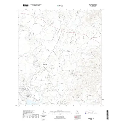
2019 Map of Pipe Creek
USGS Topo · Published 2019About this map
The Medina River carves a winding path through this corner of the Texas Hill Country, feeding into the northern reaches of Medina Lake at the settlement of Lake Medina Shores. This 2019 survey documents a landscape of limestone ridges and spring-fed creeks, where historical communities like Pipe Creek and Bandera Falls serve as focal points for local commerce and history. Significant topographic features such as Edwards Mtn and Smoothing Iron Mtn define the horizon, while the Pipe Creek Cem offers a grounded touchpoint for genealogical research. The presence of the Medina River Ranch Airport and numerous named springs, including Cool Springs and Norton Spring, illustrates the region's reliance on both modern connectivity and its essential water sources. This map also identifies unique landmarks like Wonder Hole, suggesting a terrain rich with karst features and local lore.
Find a feature on this map
154 named features on this map. Tap any name to fly to it.
Don’t see what you’re looking for? This feature index may not catch every label — zoom into the map to look around manually.
Map Details
Editions of this 2019 Pipe Creek Map
This is the sole edition of this map. No revisions or reprints were ever made.
Other maps of this area

1954 · San Antonio
USGS Topo · 1:250,000

1956 · Comfort
USGS Topo · 1:62,500

1956 · Bandera
USGS Topo · 1:62,500

1956 · Medina Lake
USGS Topo · 1:62,500

1956 · Center Point
USGS Topo · 1:62,500

1957 · San Antonio
USGS Topo · 1:250,000

1964 · Bandera
USGS Topo · 1:24,000

1964 · Timber Creek
USGS Topo · 1:24,000

1964 · Medina Lake
USGS Topo · 1:24,000
1964 · Ranger Creek
USGS Topo · 1:24,000