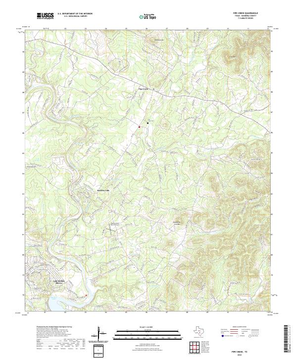
2022 Map of Pipe Creek
USGS Topo · Published 2022About this map
The Medina River carves through the heart of the Texas Hill Country, shaping a landscape defined by dramatic bluffs and seasonal springs. Along its course, the settlement of Bandera Falls and the residential development of Lake Medina Shores mark the transition toward the sprawling Medina Lake reservoir. Further northeast, the community of Pipe Creek serves as a local hub, anchored by the Pipe Creek Cem and providing access to the rugged elevations of Edwards Mtn and Cap Mtn.
Find a feature on this map
155 named features on this map. Tap any name to fly to it.
Don’t see what you’re looking for? This feature index may not catch every label — zoom into the map to look around manually.
Map Details
Editions of this 2022 Pipe Creek Map
This is the sole edition of this map. No revisions or reprints were ever made.
Other maps of this area

1954 · San Antonio
USGS Topo · 1:250,000

1956 · Comfort
USGS Topo · 1:62,500

1956 · Bandera
USGS Topo · 1:62,500

1956 · Medina Lake
USGS Topo · 1:62,500

1956 · Center Point
USGS Topo · 1:62,500

1957 · San Antonio
USGS Topo · 1:250,000

1964 · Bandera
USGS Topo · 1:24,000

1964 · Timber Creek
USGS Topo · 1:24,000

1964 · Medina Lake
USGS Topo · 1:24,000
1964 · Ranger Creek
USGS Topo · 1:24,000