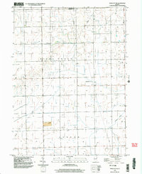
1998 Map of Piper City NE
USGS Topo · Published 2003About this map
Milks Grove and Ashkum townships anchor this agricultural landscape in the late 1990s, where the straight lines of rural section roads and multiple Pipelines intersect the meandering course of Langan Creek. The terrain is defined by a rigorous grid of drainage and property lines, punctuated by local landmarks like a Quarry and a Cem that speak to the long-standing community footprint in this part of Iroquois County. Aviation and utility infrastructure are surprisingly prominent for a rural district, featuring the Porter Landing Strip in the northwest and Berns Landing Strip further east, alongside a high-elevation Tower and several Well sites. This survey captures a moment of modern land management just before the 21st century, where industrial utilities and small-scale private airstrips coexist with traditional Midwestern township boundaries.
Find a feature on this map
13 named features on this map. Tap any name to fly to it.
Don’t see what you’re looking for? This feature index may not catch every label — zoom into the map to look around manually.
Map Details
Editions of this 1998 Piper City NE Map
This is the sole edition of this map. No revisions or reprints were ever made.
Other maps of this area

1922 · Kankakee
USGS Topo · 1:62,500

1923 · Herscher
USGS Topo · 1:62,500

1924 · Kankakee
USGS Topo · 1:62,500

1925 · Herscher
USGS Topo · 1:62,500

1944 · Piper City
USGS Topo · 1:48,000

1944 · Gilman
USGS Topo · 1:62,500

1946 · Gilman
USGS Topo · 1:62,500

1947 · Piper City
USGS Topo · 1:62,500

1953 · Chicago
USGS Topo · 1:250,000

1953 · Danville
USGS Topo · 1:250,000