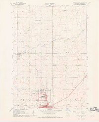
1967 Map of Pipestone North
USGS Topo · Published 1969About this map
Pipestone National Monument anchors the southern edge of this Minnesota landscape, preserving the sacred catlinite quarries used by Plains tribes for centuries. The surrounding terrain is a grid of agricultural townships including Altona, Troy, and Grange, where the upper reaches of the North Branch Pipestone Creek wind through prairie lands. The city of Pipestone serves as the regional hub, its growth and layout shaped by a junction of major rail lines, including the Chicago and North Western and the Chicago Milwaukee St Paul and Pacific. Conservation areas such as the Troy State Wildlife Management Area and the Pipestone Indian State Wildlife Management Area indicate a long-standing local commitment to preserving native wetlands and prairie habitats alongside the intensive farming operations and numerous Gravel Pits that supported the local infrastructure during the late 1960s.
Find a feature on this map
32 named features on this map. Tap any name to fly to it.
Don’t see what you’re looking for? This feature index may not catch every label — zoom into the map to look around manually.
Map Details
Editions of this 1967 Pipestone North Map
2 editions found
Other maps of this area

1953 · Watertown
USGS Topo · 1:250,000

1955 · Sioux Falls
USGS Topo · 1:250,000

1958 · Sioux Falls
USGS Topo · 1:250,000

1958 · Watertown
USGS Topo · 1:250,000

1967 · Pipestone North
USGS Topo · 1:24,000

1967 · Edgerton North
USGS Topo · 1:24,000

1967 · Ruthton NW
USGS Topo · 1:24,000

1967 · Elkton SW
USGS Topo · 1:24,000

1967 · Verdi
USGS Topo · 1:24,000

1967 · Pipestone South
USGS Topo · 1:24,000