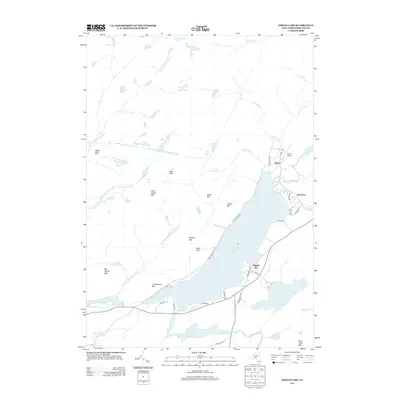
2013 Map of Piseco Lake
USGS Topo · Published 2013About this map
Piseco Lake dominates this Hamilton County landscape, serving as the focal point for the lakeside communities of Piseco, Rudeston, and Higgins Bay. This 2013 survey reveals the distribution of private roads and state-maintained routes like State Park Rd and S Shore Rd that provide access to the waterfront and the surrounding highlands. The topography is defined by numerous peaks, including Piseco Mtn and Panther Mtn, which separate the central lake basin from a complex drainage network involving Spy Lake, Oxbow Lake, and the winding Jessup River to the north.
Find a feature on this map
56 named features on this map. Tap any name to fly to it.
Don’t see what you’re looking for? This feature index may not catch every label — zoom into the map to look around manually.
Map Details
Editions of this 2013 Piseco Lake Map
This is the sole edition of this map. No revisions or reprints were ever made.
Other maps of this area

1899 · Indian Lake
USGS Topo · 1:62,500

1900 · Canada Lake
USGS Topo · 1:62,500

1902 · Indian Lake
USGS Topo · 1:62,500

1903 · West Canada Lakes
USGS Topo · 1:62,500

1904 · Piseco Lake
USGS Topo · 1:62,500

1906 · Piseco Lake
USGS Topo · 1:62,500

1907 · Lake Pleasant
USGS Topo · 1:62,500

1908 · Piseco Lake
USGS Topo · 1:62,500

1950 · Utica
USGS Topo · 1:250,000

1954 · Lake Pleasant
USGS Topo · 1:62,500