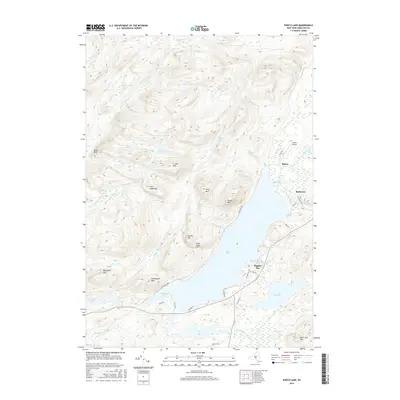
2016 Map of Piseco Lake
USGS Topo · Published 2016About this map
Piseco Lake and its surrounding peaks dominate this Hamilton County terrain, illustrating a landscape defined by water and high relief. The small settlements of Piseco and Rudeston are located along the northeastern shore, served by the Piseco Airport and a network of local roads like Old Piseco Rd. The map reveals a complex hydrologic system where Fall Stream and Jessup River feed into the northern basins, while the Piseco Outlet drains the southern end of Big Bay.
Find a feature on this map
52 named features on this map. Tap any name to fly to it.
Don’t see what you’re looking for? This feature index may not catch every label — zoom into the map to look around manually.
Map Details
Editions of this 2016 Piseco Lake Map
This is the sole edition of this map. No revisions or reprints were ever made.
Other maps of this area

1899 · Indian Lake
USGS Topo · 1:62,500

1900 · Canada Lake
USGS Topo · 1:62,500

1902 · Indian Lake
USGS Topo · 1:62,500

1903 · West Canada Lakes
USGS Topo · 1:62,500

1904 · Piseco Lake
USGS Topo · 1:62,500

1906 · Piseco Lake
USGS Topo · 1:62,500

1907 · Lake Pleasant
USGS Topo · 1:62,500

1908 · Piseco Lake
USGS Topo · 1:62,500

1950 · Utica
USGS Topo · 1:250,000

1954 · Lake Pleasant
USGS Topo · 1:62,500