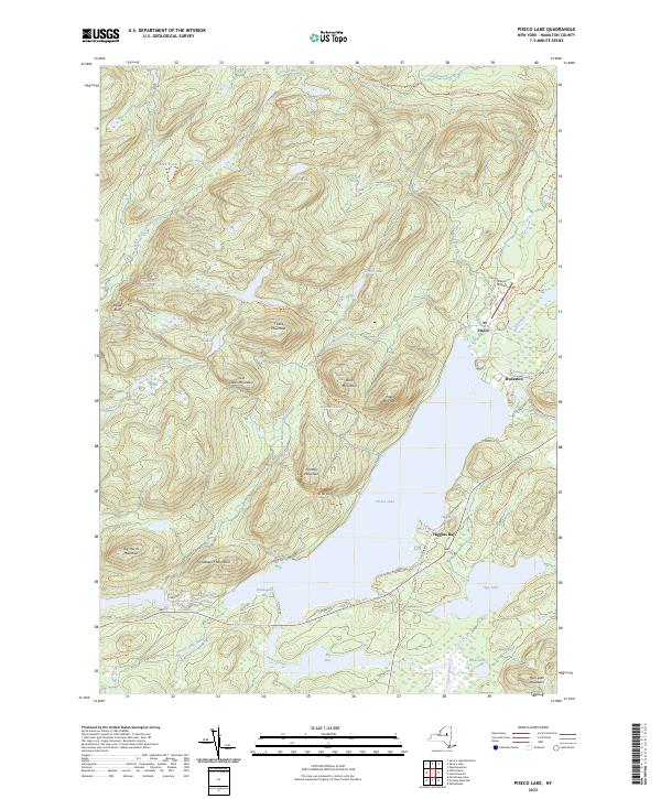
2023 Map of Piseco Lake
USGS Topo · Published 2023About this map
Piseco Lake and its surrounding peaks anchor this 2023 survey of the southern Adirondacks, where the small settlements of Piseco and Rudeston cling to the eastern shoreline. The landscape is defined by its water and elevation, from the high Eagle Bluff and Panther Mountain to the sprawling Spy Lake and Mud Lake systems to the southeast. The backcountry is accessible via an intricate network of specialized paths including the Northville-Placid Trl and the Piseco-Perkins Clearing Trl, reflecting the area's modern identity as a hub for outdoor recreation and wilderness conservation. The proximity of Piseco Airport to the water's edge underscores the unique logistical needs of this isolated mountain community. Local geography is further detailed by numerous named waterways such as Fall Stream, Cold Stream, and Jessup River, which drain the steep slopes of T Lake Mountain and Stacy Mountain.
Find a feature on this map
59 named features on this map. Tap any name to fly to it.
Don’t see what you’re looking for? This feature index may not catch every label — zoom into the map to look around manually.
Map Details
Editions of this 2023 Piseco Lake Map
This is the sole edition of this map. No revisions or reprints were ever made.
Other maps of this area

1899 · Indian Lake
USGS Topo · 1:62,500

1900 · Canada Lake
USGS Topo · 1:62,500

1902 · Indian Lake
USGS Topo · 1:62,500

1903 · West Canada Lakes
USGS Topo · 1:62,500

1904 · Piseco Lake
USGS Topo · 1:62,500

1906 · Piseco Lake
USGS Topo · 1:62,500

1907 · Lake Pleasant
USGS Topo · 1:62,500

1908 · Piseco Lake
USGS Topo · 1:62,500

1950 · Utica
USGS Topo · 1:250,000

1954 · Lake Pleasant
USGS Topo · 1:62,500