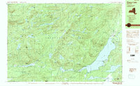
1990 Map of Piseco Lake
USGS Topo · Published 1990About this map
Adirondack Park dominates this 1990 survey, revealing the remote wilderness character of western Hamilton County at the close of the twentieth century. The landscape is defined by the expansive waters of Piseco Lake, where the small settlements of Piseco and Rudeston serve as anchors for local life near Higgins Bay. This area reflects a quiet mountain economy, with small pockets of development like Hoffmeister and Mountain Home situated along the winding valley floors.
Find a feature on this map
82 named features on this map. Tap any name to fly to it.
Don’t see what you’re looking for? This feature index may not catch every label — zoom into the map to look around manually.
Map Details
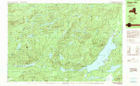
Editions of this 1990 Piseco Lake Map
2 editions found
Other maps of this area

1899 · Indian Lake
USGS Topo · 1:62,500

1900 · Canada Lake
USGS Topo · 1:62,500

1900 · Wilmurt
USGS Topo · 1:62,500

1901 · Old Forge
USGS Topo · 1:62,500

1902 · Wilmurt
USGS Topo · 1:62,500

1902 · Indian Lake
USGS Topo · 1:62,500

1903 · West Canada Lakes
USGS Topo · 1:62,500

1904 · Piseco Lake
USGS Topo · 1:62,500

1906 · Piseco Lake
USGS Topo · 1:62,500

1907 · Lake Pleasant
USGS Topo · 1:62,500