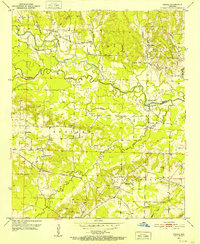
1951 Map of Pisgah
USGS Topo · Published 1952About this map
The Little Missouri River snakes through the center of this rural landscape, defining the boundary between the northern uplands and the fertile creek bottoms to the south. Small, scattered communities like Pisgah and Billstown serve as local anchors, each marked by its own burial ground such as Billstown Cem and Nash Cem. The settlement pattern reflects an era of close-knit rural life, with a high density of country churches including Bruce Chapel, Ball Chapel, and Macedonia Ch. To the south, the Prescott AND NORTHWESTERN rail line cuts across the terrain, linking the agrarian and timber interests of the region. Evidence of the local geography's utility appears in several Flowing Well labels near the river and Gravel Pits concentrated around Wallaceburg, indicating where the earth's resources were being extracted for local infrastructure at the midpoint of the twentieth century.
Find a feature on this map
42 named features on this map. Tap any name to fly to it.
Don’t see what you’re looking for? This feature index may not catch every label — zoom into the map to look around manually.
Map Details
Editions of this 1951 Pisgah Map
3 editions found
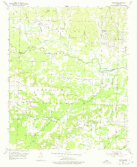
Other maps of this area

1901 · Gurdon
USGS Topo · 1:125,000

1906 · Caddo Gap
USGS Topo · 1:125,000

1943 · Antoine
USGS Topo · 1:62,500

1951 · Blevins
USGS Topo · 1:24,000

1951 · Washington
USGS Topo · 1:24,000

1951 · Pisgah
USGS Topo · 1:24,000

1951 · McCaskill
USGS Topo · 1:24,000

1953 · El Dorado
USGS Topo · 1:250,000

1955 · Little Rock
USGS Topo · 1:250,000

1956 · Little Rock
USGS Topo · 1:250,000