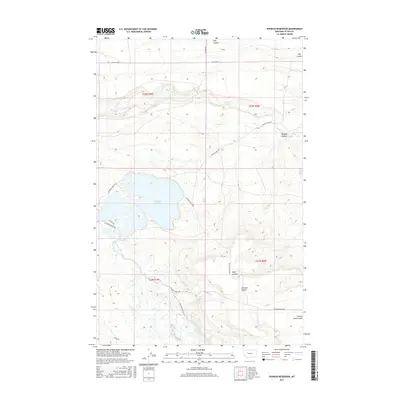
2017 Map of Pishkun Reservoir
USGS Topo · Published 2017About this map
Pishkun Reservoir dominates the high plains of Teton County, served by an intricate network of irrigation infrastructure designed to manage water across this arid landscape. The Sun River Slope Canal and various segments of the Pishkun Canal Rd trace the path of water transport essential for local agriculture. The topography is defined by a series of deep drainage features, including Wolf Coulee, Clemons Coulee, and Cutting Shed Coulee, which carve through the plains toward Deep Cr. This 2017 survey illustrates the modern configuration of these water systems and the rural road network, such as Pishkun Boadle Rd and S Bellview Rd, that provides access to the remote coulees and reservoir shores.
Find a feature on this map
20 named features on this map. Tap any name to fly to it.
Don’t see what you’re looking for? This feature index may not catch every label — zoom into the map to look around manually.
Map Details
Editions of this 2017 Pishkun Reservoir Map
This is the sole edition of this map. No revisions or reprints were ever made.
Other maps of this area

1903 · Saypo
USGS Topo · 1:125,000

1920 · Choteau
USGS Topo · 1:125,000

1955 · Choteau
USGS Topo · 1:250,000

1957 · Choteau
USGS Topo · 1:250,000

1958 · Choteau
USGS Topo · 1:250,000

1958 · Lake Theboe
USGS Topo · 1:24,000

1958 · Barr Creek
USGS Topo · 1:24,000
1958 · Split Rock Lake
USGS Topo · 1:24,000

1960 · Bynum
USGS Topo · 1:62,500

1960 · Gilman
USGS Topo · 1:62,500