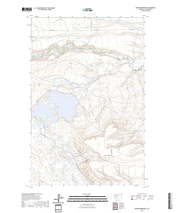
2024 Map of Pishkun Reservoir
USGS Topo · Published 2024About this map
Pishkun Reservoir dominates this landscape in Teton County, where complex water management infrastructure meets the managed wildlands of the Blackfoot Valley Conservation Area. This modern survey illustrates the hydraulic engineering required for prairie agriculture, specifically through the Sun River Slope Canal and the extensive network of irrigation conduits like the Pishkun Canal Rd. The terrain is defined by dramatic drainage features such as Deep Creek and several deep cuts including Quigley Coulee, Wolf Coulee, and Clemons Coulee. Local transportation is traced through family-named routes and utility access roads, including S Bellview Rd and Pishkun Boadle Rd, providing a clear view of the current rural infrastructure and land conservation boundaries.
Find a feature on this map
18 named features on this map. Tap any name to fly to it.
Don’t see what you’re looking for? This feature index may not catch every label — zoom into the map to look around manually.
Map Details
Editions of this 2024 Pishkun Reservoir Map
This is the sole edition of this map. No revisions or reprints were ever made.
Other maps of this area

1903 · Saypo
USGS Topo · 1:125,000

1920 · Choteau
USGS Topo · 1:125,000

1955 · Choteau
USGS Topo · 1:250,000

1957 · Choteau
USGS Topo · 1:250,000

1958 · Choteau
USGS Topo · 1:250,000

1958 · Lake Theboe
USGS Topo · 1:24,000

1958 · Barr Creek
USGS Topo · 1:24,000
1958 · Split Rock Lake
USGS Topo · 1:24,000

1960 · Bynum
USGS Topo · 1:62,500

1960 · Gilman
USGS Topo · 1:62,500