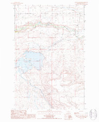
1987 Map of Pishkun Reservoir
USGS Topo · Published 1987About this map
Pishkun Reservoir dominates the central landscape of this Teton County survey, serving as a focal point for the regional irrigation infrastructure during the late twentieth century. The map illustrates the complex water management systems of the era, notably the Sun River Slope Canal which winds through the varied topography to the south and east of the reservoir. This engineered waterway represents a significant modification of the arid environment, redirecting vital resources across the drainage basins of Deep Creek and Quigley Coulee.
Find a feature on this map
8 named features on this map. Tap any name to fly to it.
Don’t see what you’re looking for? This feature index may not catch every label — zoom into the map to look around manually.
Map Details
Editions of this 1987 Pishkun Reservoir Map
This is the sole edition of this map. No revisions or reprints were ever made.
Other maps of this area

1903 · Saypo
USGS Topo · 1:125,000

1920 · Choteau
USGS Topo · 1:125,000

1955 · Choteau
USGS Topo · 1:250,000

1957 · Choteau
USGS Topo · 1:250,000

1958 · Choteau
USGS Topo · 1:250,000

1958 · Lake Theboe
USGS Topo · 1:24,000

1958 · Barr Creek
USGS Topo · 1:24,000
1958 · Split Rock Lake
USGS Topo · 1:24,000

1960 · Bynum
USGS Topo · 1:62,500

1960 · Gilman
USGS Topo · 1:62,500