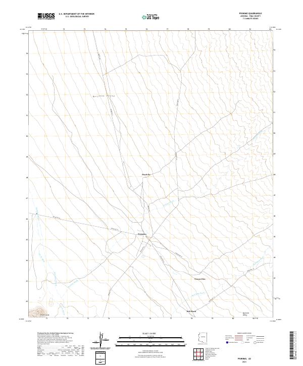
2021 Map of Pisinimo
USGS Topo · Published 2021About this map
Pisinimo serves as a central hub in this arid landscape of Pima County, situated at the junction of several desert transit routes including Indian Rte 21 and Indian Rte 28. The settlement pattern is defined by its relationship to the broad Quijotoa Valley, where seasonal drainages like Pisinimo Wash and Hali Murk Wash dictate the topography. Small, discrete residential clusters such as Peach Pu to the north and Viason Chin to the south illustrate the traditional dispersed settlement structure of the Tohono O'odham Nation. These communities are linked by a network of specialized roads like Indian Rte 1, which traverses the valley floor. The map records a moment where modern infrastructure meets the ancient natural flow of the San Simon Wash and Gu Vo Wash, providing an essential view of local geography and land use in southern Arizona.
Find a feature on this map
19 named features on this map. Tap any name to fly to it.
Don’t see what you’re looking for? This feature index may not catch every label — zoom into the map to look around manually.
Map Details
Editions of this 2021 Pisinimo Map
This is the sole edition of this map. No revisions or reprints were ever made.
Other maps of this area

1953 · Ajo
USGS Topo · 1:250,000

1954 · Sonoyta
USGS Topo · 1:250,000

1957 · Ajo
USGS Topo · 1:250,000

1958 · Ajo
USGS Topo · 1:250,000

1962 · Ajo
USGS Topo · 1:250,000

1963 · Ajo
USGS Topo · 1:250,000

1963 · Kom Vo
USGS Topo · 1:62,500

1963 · Gu Oidak
USGS Topo · 1:62,500

1963 · Quijotoa Mts
USGS Topo · 1:62,500

1963 · Pisinimo
USGS Topo · 1:62,500
Featured Places
- Peach Pu, Pisinemo District
- Viason Chin, Pisinemo District
- Hali Murk, Pisinemo District
- Pisinimo, Pisinemo District
- Pisinemo District, AZ