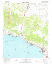
1965 Map of Pismo Beach
USGS Topo · Published 1975About this map
The central California coastline during the mid-1960s reveals a landscape defined by sharp elevation changes between the Irish Hills and the waters of San Luis Obispo Bay. Development is concentrated along the coastal shelf, where Us Highway 101 serves as the primary artery connecting the communities of Avila Beach, Shell Beach, and Pismo Beach. The map illustrates a transition from rural canyon lands like See Canyon and Squire Canyon to the growing suburban footprint of Grover City in the south.
Find a feature on this map
51 named features on this map. Tap any name to fly to it.
Don’t see what you’re looking for? This feature index may not catch every label — zoom into the map to look around manually.
Map Details
Editions of this 1965 Pismo Beach Map
4 editions found
Other maps of this area

1897 · Port Harford
USGS Topo · 1:62,500

1897 · San Luis Obispo
USGS Topo · 1:62,500

1897 · Cayucos
USGS Topo · 1:62,500

1897 · Arroyo Grande
USGS Topo · 1:62,500

1900 · San Luis
USGS Topo · 1:125,000

1937 · Cayucos
USGS Topo · 1:62,500

1941 · Port San Luis
USGS Topo · 1:62,500

1942 · San Luis Obispo
USGS Topo · 1:62,500

1942 · Arroyo Grande
USGS Topo · 1:62,500

1943 · Cayucos
USGS Topo · 1:62,500