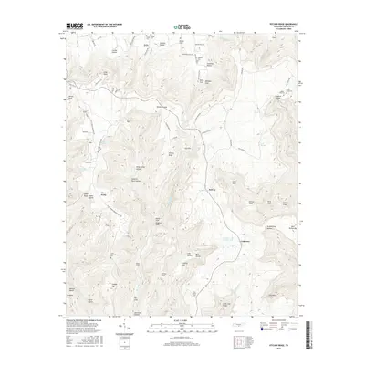
2016 Map of Pitcher Ridge
USGS Topo · Published 2016About this map
Lakeview and Sal City anchor this Tennessee landscape, characterized by an intricate system of coves and hollows that define local settlement patterns. The topographical complexity of the region is evident in named features like Windtrace Gap and Hickory Ridge, which separate distinct valley communities. Family and locality names are preserved through numerous burial sites, including Rice Field Cem and Little Mountain Cem, offering clear value for genealogical research. The presence of Lakeview Lake Number One and various springs like Keith Spring highlights the importance of water sources in this upland environment. The road network, including Turnpike Rd and Keith Springs Mountain Rd, follows the contours of the land, connecting isolated points such as Three Forks and Long Point across the rugged Pitcher Ridge terrain.
Find a feature on this map
88 named features on this map. Tap any name to fly to it.
Don’t see what you’re looking for? This feature index may not catch every label — zoom into the map to look around manually.
Map Details
Editions of this 2016 Pitcher Ridge Map
This is the sole edition of this map. No revisions or reprints were ever made.
Other maps of this area

1886 · Stevenson
USGS Topo · 1:125,000

1888 · Scottsboro
USGS Topo · 1:125,000

1892 · Scottsboro
USGS Topo · 1:125,000

1892 · Stevenson
USGS Topo · 1:125,000

1895 · Stevenson
USGS Topo · 1:125,000

1895 · Sewanee
USGS Topo · 1:125,000

1928 · Decherd
USGS Topo · 1:62,500

1936 · Sewanee
USGS Topo · 1:24,000

1936 · Sinking Cove
USGS Topo · 1:24,000

1936 · Beans Creek
USGS Topo · 1:24,000