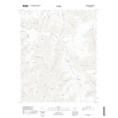
2019 Map of Pitcher Ridge
USGS Topo · Published 2019About this map
Keith Spring Cem and Posey Field Cem are among several family and community burial sites situated within the deep coves of Franklin County. This corner of the southern Cumberland Plateau is defined by its complex drainage and ridge systems, where waters from Sal City Spring and Hurricane Cr carve through Keith Cove and Davis Cove. The settlement pattern follows these narrow valley floors and gaps, with homes and small farms clustered near water sources like Keith Spring. Along the southern portion of the sheet, the landscape transitions toward Lakeview, featuring Lakeview Lake Number One. The terrain is notably indented by numerous "coves" such as Sinking Cove and Farmer Cove, which reflect the karst topography of the region where surface water often disappears into subterranean channels.
Find a feature on this map
94 named features on this map. Tap any name to fly to it.
Don’t see what you’re looking for? This feature index may not catch every label — zoom into the map to look around manually.
Map Details
Editions of this 2019 Pitcher Ridge Map
This is the sole edition of this map. No revisions or reprints were ever made.
Other maps of this area

1886 · Stevenson
USGS Topo · 1:125,000

1888 · Scottsboro
USGS Topo · 1:125,000

1892 · Scottsboro
USGS Topo · 1:125,000

1892 · Stevenson
USGS Topo · 1:125,000

1895 · Stevenson
USGS Topo · 1:125,000

1895 · Sewanee
USGS Topo · 1:125,000

1928 · Decherd
USGS Topo · 1:62,500

1936 · Sewanee
USGS Topo · 1:24,000

1936 · Sinking Cove
USGS Topo · 1:24,000

1936 · Beans Creek
USGS Topo · 1:24,000