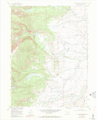
1955 Map of Pitchpine Mountain
USGS Topo · Published 1990About this map
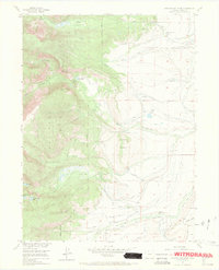
Routt National Forest dominates the western portion of this mid-century landscape, characterized by the high elevations of Pitchpine Mountain and the water-shedding canyons of the Roaring Fork. To the east, the terrain transitions into a highly developed irrigation network essential for high-altitude ranching. This complex system of water management is visible through numerous named structures like the Lone Pine Ditch, Wolfer Ditch, and Lillie Ditch, which redirect water from alpine streams to support livestock operations. Settlement patterns here are defined by established family holdings rather than towns, with several significant sites noted including Carlstrom Brothers Ranch, Brands Ranch, and Emigh Ranch. These ranching outposts, connected by improved and unimproved routes like the Grizzly Helena Trail, underscore the remote agricultural economy of Jackson County before the era of widespread modern development. Alpine features such as Ceanothuse Lake and Livingston Park offer a look at the undisturbed backcountry of the era.
Find a feature on this map
45 named features on this map. Tap any name to fly to it.
Don’t see what you’re looking for? This feature index may not catch every label — zoom into the map to look around manually.
Map Details
Editions of this 1955 Pitchpine Mountain Map
7 editions found
Other maps of this area

1911 · Hahns Peak
USGS Topo · 1:125,000

1913 · Hahns Peak
USGS Topo · 1:125,000

1954 · Craig
USGS Topo · 1:250,000

1955 · Lake John
USGS Topo · 1:24,000

1955 · Buffalo Pass
USGS Topo · 1:24,000

1955 · Mount Zirkel
USGS Topo · 1:24,000

1955 · Pitchpine Mountain
USGS Topo · 1:24,000

1955 · Mount Ethel
USGS Topo · 1:24,000

1955 · Teal Lake
USGS Topo · 1:24,000

1955 · Delaney Butte
USGS Topo · 1:24,000