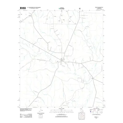
2012 Map of Pitkin
USGS Topo · Published 2012About this map
Pitkin and the surrounding piney woods of Vernon Parish are defined by an intricate network of waterways and rural roads in this 2012 topographic study. The settlement of Pitkin serves as a local hub, featuring its own Po and the nearby Mathis Cem. To the north, the site of Fullerton sits near the headwaters of Turkey Cr, while the community of Dido occupies the southeastern corner. The landscape is carved by a complex drainage system including Sixmile Cr, Big Brushy Cr, and Soapstone Cr, which highlight the area's low-lying, creek-bottom geography.
Find a feature on this map
76 named features on this map. Tap any name to fly to it.
Don’t see what you’re looking for? This feature index may not catch every label — zoom into the map to look around manually.
Map Details
Editions of this 2012 Pitkin Map
This is the sole edition of this map. No revisions or reprints were ever made.
Other maps of this area

1941 · Slagle
USGS Topo · 1:62,500

1943 · Leander
USGS Topo · 1:62,500

1944 · Slagle
USGS Topo · 1:62,500

1947 · Steep Gully
USGS Topo · 1:31,680

1947 · Elizabeth
USGS Topo · 1:31,680

1947 · Grant
USGS Topo · 1:31,680

1947 · Sugartown
USGS Topo · 1:31,680

1947 · Sugrue
USGS Topo · 1:31,680

1947 · Pitkin
USGS Topo · 1:31,680

1948 · Grant
USGS Topo · 1:24,000