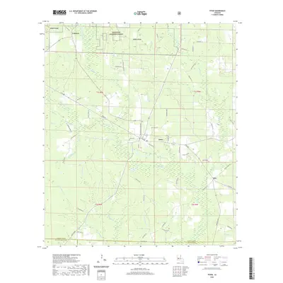
2020 Map of Pitkin
USGS Topo · Published 2020About this map
Fullerton and Pitkin anchor this survey of the western Louisiana piney woods, where the landscape is defined by the extensive headwaters of the Sixmile Creek and Big Brushy Creek systems. The map documents a rural corridor transitioning between the protected lands of the Kisatchie National Forest and the military grounds of Fort Polk. Settled life is noted at the smaller community of Dido and through family-oriented landmarks like Mathis Cemetery and Hunts Farm. The drainage patterns of the many branches, including Soapstone Creek and Schoolhouse Branch, indicate the low-lying, well-watered geography of Vernon Parish. Transport in the area is a network of local parish roads and named routes like Pitkin Road, illustrating the sparse but organized settlement pattern of the early 21st century.
Find a feature on this map
71 named features on this map. Tap any name to fly to it.
Don’t see what you’re looking for? This feature index may not catch every label — zoom into the map to look around manually.
Map Details
Editions of this 2020 Pitkin Map
This is the sole edition of this map. No revisions or reprints were ever made.
Other maps of this area

1941 · Slagle
USGS Topo · 1:62,500

1943 · Leander
USGS Topo · 1:62,500

1944 · Slagle
USGS Topo · 1:62,500

1947 · Steep Gully
USGS Topo · 1:31,680

1947 · Elizabeth
USGS Topo · 1:31,680

1947 · Grant
USGS Topo · 1:31,680

1947 · Sugartown
USGS Topo · 1:31,680

1947 · Sugrue
USGS Topo · 1:31,680

1947 · Pitkin
USGS Topo · 1:31,680

1948 · Grant
USGS Topo · 1:24,000