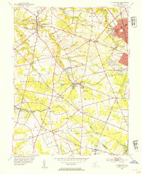
1953 Map of Pitman West
USGS Topo · Published 1954About this map
Raccoon Creek and its many tributaries, including Edwards Run and Clems Run, define the agricultural and residential landscape of this Gloucester County region in the early 1950s. The map illustrates a network of small settlements such as Richwood, Ewan, and Aura linked by rural roads and the Pennsylvania-Reading Seashore Lines railroad, which skirts the eastern edge through Glassboro. This era shows the transition of the land from intensive milling and farming to suburban expansion around Pitman.
Find a feature on this map
55 named features on this map. Tap any name to fly to it.
Don’t see what you’re looking for? This feature index may not catch every label — zoom into the map to look around manually.
Map Details
Editions of this 1953 Pitman West Map
2 editions found
Other maps of this area

1890 · Salem
USGS Topo · 1:62,500

1890 · Glassboro
USGS Topo · 1:62,500

1891 · Philadelphia
USGS Topo · 1:62,500

1894 · Chester
USGS Topo · 1:62,500

1894 · Philadelphia
USGS Topo · 1:62,500

1896 · Philadelphia
USGS Topo · 1:62,500

1896 · Chester
USGS Topo · 1:62,500

1898 · Salem
USGS Topo · 1:62,500

1898 · Glassboro
USGS Topo · 1:62,500

1898 · Chester
USGS Topo · 1:62,500