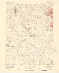
1953 Map of Pitman West
USGS Topo · Published 1954About this map
Raccoon Creek and its many tributaries, including Edwards Run and Miery Run, weave through this rural Gloucester County landscape. The settlement of Mullica Hill serves as a northern anchor, characterized by landmarks like St Stephens Ch and the Mullica Hill Pond. To the east, the edge of Pitman and Glassboro shows early mid-century growth along the Pennsylvania-Reading Seashore Lines. Smaller community hubs like Richwood, featuring the Richwood Academy, and the milling sites of Wrights Mill and Jessups Mill reflect an economy tied to both local water power and regional transport. The presence of crossroads like Pine Tavern and Whiglane highlights the historic road network that connected these agricultural townships.
Find a feature on this map
54 named features on this map. Tap any name to fly to it.
Don’t see what you’re looking for? This feature index may not catch every label — zoom into the map to look around manually.
Map Details
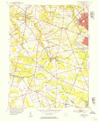
Editions of this 1953 Pitman West Map
2 editions found
Other maps of this area

1890 · Salem
USGS Topo · 1:62,500

1890 · Glassboro
USGS Topo · 1:62,500

1891 · Philadelphia
USGS Topo · 1:62,500

1894 · Chester
USGS Topo · 1:62,500

1894 · Philadelphia
USGS Topo · 1:62,500

1896 · Philadelphia
USGS Topo · 1:62,500

1896 · Chester
USGS Topo · 1:62,500

1898 · Salem
USGS Topo · 1:62,500

1898 · Glassboro
USGS Topo · 1:62,500

1898 · Chester
USGS Topo · 1:62,500