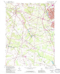
1967 Map of Pitman West
USGS Topo · Published 1994About this map
Raccoon Creek and its many tributaries carve through this Gloucester County landscape, defining the layout of historic crossroads settlements like Mullica Hill and Ewan. The map captures a transition from traditional agricultural and milling sites, such as Wrights Mill and Jessups Mill Pond, to the expanding residential footprints of Pitman and Glassboro. In the southern reaches, the wetlands of Elephant Swamp and Loggerhead Pond remain largely undeveloped, contrasting with the active corridors along Bridgeton Pike and the established campus of Clearview Regional High School. Genealogists may find value in the scattered local landmarks, including Mt Calvary Cem and several community houses of worship like Siloam Ch and Holy Name Ch. The inclusion of an Old Railroad Grade and the Landing Strip reflects the changing transportation infrastructure of the mid-20th century.
Find a feature on this map
87 named features on this map. Tap any name to fly to it.
Don’t see what you’re looking for? This feature index may not catch every label — zoom into the map to look around manually.
Map Details
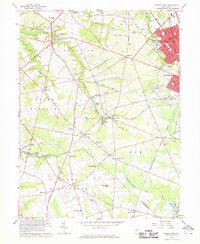
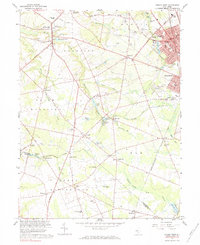
Editions of this 1967 Pitman West Map
3 editions found
Other maps of this area

1890 · Salem
USGS Topo · 1:62,500

1890 · Glassboro
USGS Topo · 1:62,500

1891 · Philadelphia
USGS Topo · 1:62,500

1894 · Chester
USGS Topo · 1:62,500

1894 · Philadelphia
USGS Topo · 1:62,500

1896 · Philadelphia
USGS Topo · 1:62,500

1896 · Chester
USGS Topo · 1:62,500

1898 · Salem
USGS Topo · 1:62,500

1898 · Glassboro
USGS Topo · 1:62,500

1898 · Chester
USGS Topo · 1:62,500