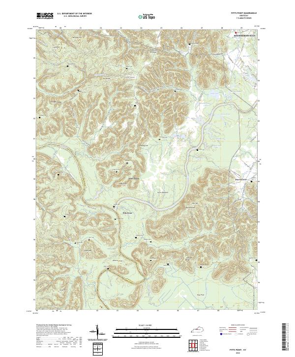
2022 Map of Pitts Point
USGS Topo · Published 2022About this map
The confluence of the Salt River and the Rolling Fork marks the heart of this landscape, defining the boundary between Bullitt and Hardin counties. In this deeply dissected terrain, the settlement of Pitts Point sits near the river junction, surrounded by family cemeteries that reflect generations of local residency, including Hardy Cem, Froman Cem, and Snellen Cem. The topography is defined by prominent knobs and ridges such as Sugar Loaf, Rising Sun Ridge, and The Knobs, which rise above the flat bottoms of Atherton Flats and Hays Flats. To the northeast, the outskirts of Shepherdsville appear near Bills Lake, while the eastern portion of the sheet is dotted with smaller communities like Beech Grove. This 2022 survey documents a complex network of forest roads and historic hollows, including Froman Hollow and Rodgers Hollow, where small ponds like Pearl Pond and Grenwells Pond collect in the valleys.
Find a feature on this map
94 named features on this map. Tap any name to fly to it.
Don’t see what you’re looking for? This feature index may not catch every label — zoom into the map to look around manually.
Map Details
Editions of this 2022 Pitts Point Map
This is the sole edition of this map. No revisions or reprints were ever made.
Other maps of this area

1907 · Louisville
USGS Topo · 1:62,500

1909 · Kosmosdale
USGS Topo · 1:48,000

1912 · Kosmosdale
USGS Topo · 1:62,500

1936 · Vine Grove
USGS Topo · 1:62,500

1943 · Vine Grove
USGS Topo · 1:62,500

1946 · Pitts Point
USGS Topo · 1:24,000

1946 · Fort Knox
USGS Topo · 1:24,000

1946 · Colesburg
USGS Topo · 1:24,000

1946 · Vine Grove
USGS Topo · 1:24,000

1946 · Vine Grove
USGS Topo · 1:62,500