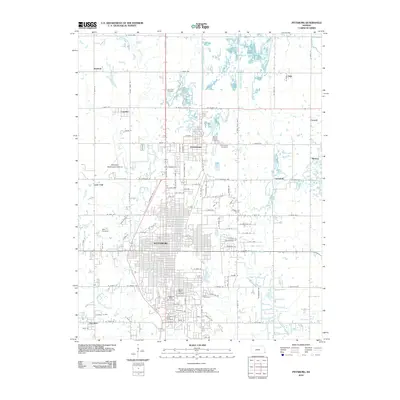
2010 Map of Pittsburg
USGS Topo · Published 2010About this map
Pittsburg and the neighboring community of Frontenac dominate this landscape in southeast Kansas, characterized by a dense grid of residential streets and the expansive campus of Pittsburg State University. The geography is defined by a historical legacy of land use, evidenced by the numerous cemeteries scattered across the quadrangle, including Mount Olive Cemetery, Highland Park Cemetery, and Lone Star Cemetery. Small outlying settlements such as Chicopee, Dunkirk, and Yale ring the larger urban center, connected by a network of rural routes like W North County Rd and N Free Kings Hwy. Waterways like First Cow Creek and East Cow Creek meander through the terrain, while the Atkinson Municipal Airport serves as a prominent modern landmark in the western portion of the survey. The concentration of cemeteries and distinct small-town clusters reflects the region's long-established mining and agricultural settlement patterns.
Find a feature on this map
108 named features on this map. Tap any name to fly to it.
Don’t see what you’re looking for? This feature index may not catch every label — zoom into the map to look around manually.
Map Details
Editions of this 2010 Pittsburg Map
This is the sole edition of this map. No revisions or reprints were ever made.
Other maps of this area

1884 · Fort Scott
USGS Topo · 1:125,000

1886 · Joplin
USGS Topo · 1:125,000

1886 · Fort Scott
USGS Topo · 1:125,000

1893 · Fort Scott
USGS Topo · 1:125,000

1894 · Joplin
USGS Topo · 1:125,000

1943 · Cherokee
USGS Topo · 1:62,500

1945 · Pittsburg
USGS Topo · 1:62,500

1945 · Cherokee
USGS Topo · 1:62,500

1947 · Joplin
USGS Topo · 1:250,000

1947 · Pittsburg
USGS Topo · 1:62,500