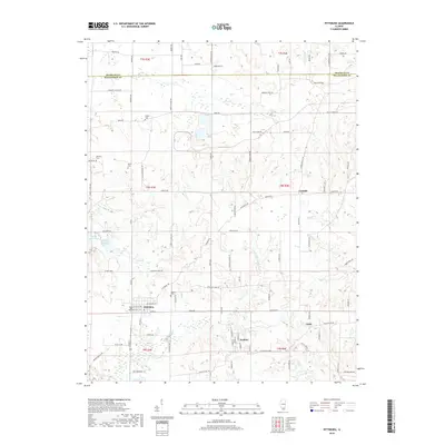
2018 Map of Pittsburg
USGS Topo · Published 2018About this map
Pittsburg and its surrounding rural corridors in Williamson and Franklin counties are defined by a network of creeks and small family-named landmarks. The landscape is heavily dissected by waterways such as Crab Orchard Cr and Pond Cr, which flow through a topography mapped in ten-foot contour intervals. This detailed view shows the transition from the concentrated residential streets of the village to the sprawling agrarian holdings to the east and north. For local history researchers, the map identifies several small burial grounds, including Stilley Cem, Sanders Cem, and Murphy Cem, often located near crossroads or along older sections of road such as Jordans Fort Rd. To the west, the presence of Fresh Water Lake and Johnston City Lake indicates the importance of water management and recreation in this part of Southern Illinois. The map also records small communities like Corinth, Attila, and Paulton, which serve as quiet anchors for the surrounding farmsteads.
Find a feature on this map
98 named features on this map. Tap any name to fly to it.
Don’t see what you’re looking for? This feature index may not catch every label — zoom into the map to look around manually.
Map Details
Editions of this 2018 Pittsburg Map
This is the sole edition of this map. No revisions or reprints were ever made.
Other maps of this area

1908 · Galatia
USGS Topo · 1:62,500

1909 · West Frankfort
USGS Topo · 1:62,500

1925 · Marion
USGS Topo · 1:62,500

1925 · Harrisburg
USGS Topo · 1:62,500

1938 · Galatia
USGS Topo · 1:62,500

1939 · Harrisburg
USGS Topo · 1:62,500

1940 · Marion
USGS Topo · 1:62,500

1941 · West Frankfort
USGS Topo · 1:62,500

1949 · Paducah
USGS Topo · 1:250,000

1950 · Paducah
USGS Topo · 1:250,000