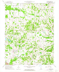
1963 Map of Pittsburg
USGS Topo · Published 1964About this map
Pittsburg serves as the central hub of this Southern Illinois landscape during the early 1960s, situated just south of the Franklin and Williamson County line. The area's industrial character is defined by the Missouri Pacific railroad line and energy extraction sites like the Freeman No 4 Mine and scattered Oil Wells. Community life is anchored by a dense network of rural institutions, including the Lincoln Sch and numerous country churches such as Williams Prairie Ch and Union Grove Ch. Water features like Johnston City Lake and Crab Orchard Creek provide the primary drainage for the undulating terrain. Small rural clusters at Corinth, Paulton, and Attila are clearly documented, often accompanied by family-named landmarks like Harris Cem and Murphey Cem, offering precise data points for genealogical research and local history studies.
Find a feature on this map
32 named features on this map. Tap any name to fly to it.
Don’t see what you’re looking for? This feature index may not catch every label — zoom into the map to look around manually.
Map Details
Editions of this 1963 Pittsburg Map
This is the sole edition of this map. No revisions or reprints were ever made.
Other maps of this area

1908 · Galatia
USGS Topo · 1:62,500

1909 · West Frankfort
USGS Topo · 1:62,500

1925 · Marion
USGS Topo · 1:62,500

1925 · Harrisburg
USGS Topo · 1:62,500

1938 · Galatia
USGS Topo · 1:62,500

1939 · Harrisburg
USGS Topo · 1:62,500

1940 · Marion
USGS Topo · 1:62,500

1941 · West Frankfort
USGS Topo · 1:62,500

1949 · Paducah
USGS Topo · 1:250,000

1950 · Paducah
USGS Topo · 1:250,000