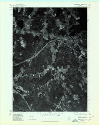
1975 Map of Pittsfield SE
USGS Topo · Published 1980About this map
Detroit and the surrounding Somerset County landscape are captured in this orthophotograph, which reveals the transition of Maine's rural topography in the mid-1970s. The aerial perspective emphasizes the winding course of the East Branch Sebasticook River as it moves through the southern portion of the quadrangle, serving as a primary geographic anchor for the settlements of Pittsfield and Detroit. Further north, Houston Corner and Palmyra appear as distinct nodes of development amidst a patchwork of managed woodlots and agricultural clearings. By using an orthophotographic base, this record provides a rare level of detail for genealogists and local historians, showing exact property boundaries, forest density, and the road networks connecting Newport to the interior. The interplay between Martin Stream and the Sebasticook drainage illustrates the water-dependent settlement patterns that shaped these communities since their founding.
Find a feature on this map
7 named features on this map. Tap any name to fly to it.
Don’t see what you’re looking for? This feature index may not catch every label — zoom into the map to look around manually.
Map Details
Editions of this 1975 Pittsfield SE Map
This is the sole edition of this map. No revisions or reprints were ever made.
Other maps of this area

1926 · Burnham
USGS Topo · 1:62,500

1930 · Pittsfield
USGS Topo · 1:48,000

1931 · Stetson
USGS Topo · 1:48,000

1932 · Brooks
USGS Topo · 1:62,500

1932 · Pittsfield
USGS Topo · 1:62,500

1933 · Pittsfield
USGS Topo · 1:62,500

1935 · Stetson
USGS Topo · 1:62,500

1948 · Bangor
USGS Topo · 1:250,000

1955 · Pittsfield
USGS Topo · 1:62,500

1955 · Brooks
USGS Topo · 1:62,500