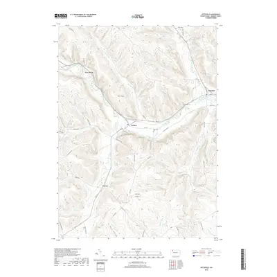
2019 Map of Pittsfield
USGS Topo · Published 2019About this map
Brokenstraw Creek winds through the northern valley of this Warren County landscape, anchoring the village of Pittsfield. The township terrain is defined by significant elevations such as Cole Hill and Pulfer Hill, with dozens of smaller drainages like Blue Eye Run and Hosmer Run carving narrow hollows through the upland. Settlement is concentrated along the river corridor and the arterial route of Rte 27, connecting the hamlets of Torpedo and Horn Siding. Genealogists will find the Riverside Cem and Whitestown Cem positioned on opposite sides of the central valley, providing clear markers of early community centers. The map also documents the timber and transport legacy of the area, noting landmarks like Baker Rocks and the winding paths of Hosmer Run Rd and Tidioute Creek Rd.
Find a feature on this map
49 named features on this map. Tap any name to fly to it.
Don’t see what you’re looking for? This feature index may not catch every label — zoom into the map to look around manually.
Map Details
Editions of this 2019 Pittsfield Map
This is the sole edition of this map. No revisions or reprints were ever made.
Other maps of this area

1926 · Youngsville
USGS Topo · 1:62,500

1927 · Tidioute
USGS Topo · 1:48,000

1927 · Titusville
USGS Topo · 1:62,500

1929 · Corry
USGS Topo · 1:48,000

1929 · Youngsville
USGS Topo · 1:62,500

1930 · Tidioute
USGS Topo · 1:62,500

1932 · Corry
USGS Topo · 1:62,500

1933 · Titusville
USGS Topo · 1:62,500

1943 · Youngsville
USGS Topo · 1:62,500

1957 · Warren
USGS Topo · 1:250,000