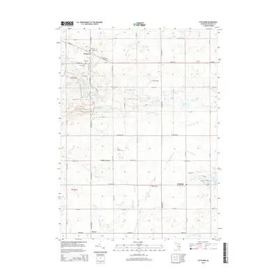
2014 Map of Pittsford
USGS Topo · Published 2014About this map
Pittsford and Prattville anchor this 2014 survey of southern Michigan, where the headwaters of the E Br Saint Joseph River wind through a landscape defined by agricultural tracts and natural lakes. The town of Pittsford sits at the intersection of S Pittsford Rd and Hudson Rd, featuring the Pittsford Millpond and several local landmarks including Leonardson Cem and Greenwood Cem. To the south, the village of Prattville is surrounded by a network of drainage systems like the Prattville Drain and Timms Drain that support the surrounding farmland.
Find a feature on this map
81 named features on this map. Tap any name to fly to it.
Don’t see what you’re looking for? This feature index may not catch every label — zoom into the map to look around manually.
Map Details
Editions of this 2014 Pittsford Map
This is the sole edition of this map. No revisions or reprints were ever made.
Other maps of this area

1913 · Alvordton
USGS Topo · 1:62,500

1914 · Pioneer
USGS Topo · 1:62,500

1944 · Pioneer
USGS Topo · 1:62,500

1944 · Alvordton
USGS Topo · 1:62,500

1953 · Fort Wayne
USGS Topo · 1:250,000

1956 · Fort Wayne
USGS Topo · 1:250,000

1959 · North Adams
USGS Topo · 1:24,000

1959 · Frontier
USGS Topo · 1:24,000

1960 · Fayette
USGS Topo · 1:24,000
1961 · Pioneer
USGS Topo · 1:24,000