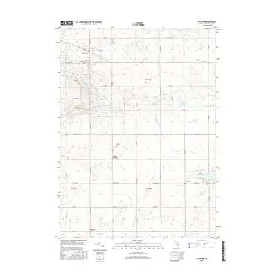
2017 Map of Pittsford
USGS Topo · Published 2017About this map
The community of Pittsford sits at the northern edge of this Hillsdale County landscape, centered near the Pittsford Millpond and the junction of Hudson Rd and S Pittsford Rd. A network of rural roads connects several smaller settlements, including Prattville and Lickly Corners, reflecting the agricultural and residential development of southern Michigan. The terrain is marked by numerous water bodies like Bell Lake, Moon Lake, and Mallory Lake, alongside complex drainage systems including the E Br Saint Joseph River and Goose Cr.
Find a feature on this map
62 named features on this map. Tap any name to fly to it.
Don’t see what you’re looking for? This feature index may not catch every label — zoom into the map to look around manually.
Map Details
Editions of this 2017 Pittsford Map
This is the sole edition of this map. No revisions or reprints were ever made.
Other maps of this area

1913 · Alvordton
USGS Topo · 1:62,500

1914 · Pioneer
USGS Topo · 1:62,500

1944 · Pioneer
USGS Topo · 1:62,500

1944 · Alvordton
USGS Topo · 1:62,500

1953 · Fort Wayne
USGS Topo · 1:250,000

1956 · Fort Wayne
USGS Topo · 1:250,000

1959 · North Adams
USGS Topo · 1:24,000

1959 · Frontier
USGS Topo · 1:24,000

1960 · Fayette
USGS Topo · 1:24,000
1961 · Pioneer
USGS Topo · 1:24,000